")
")

Oferujemy realizację numerycznych modeli terenu w oparciu o:
- lotnicze i satelitarne obrazowanie,
- mapy zasadnicze,
- pomiary własne wykonywane w terenie.
Oferujemy modele 3D zgodnie ze standardem CityGML (City Geography Markup Language) z różnymi poziomami szczegółowości określane jako LOD (Level of Details):
- LOD1 - tzw. model blokowy
- LOD2 - tzw. model uwzględniający nachylenie dachów
Modele wykonujemy z użyciem programów ArcGIS, QuantumGIS oraz SoundPLAN
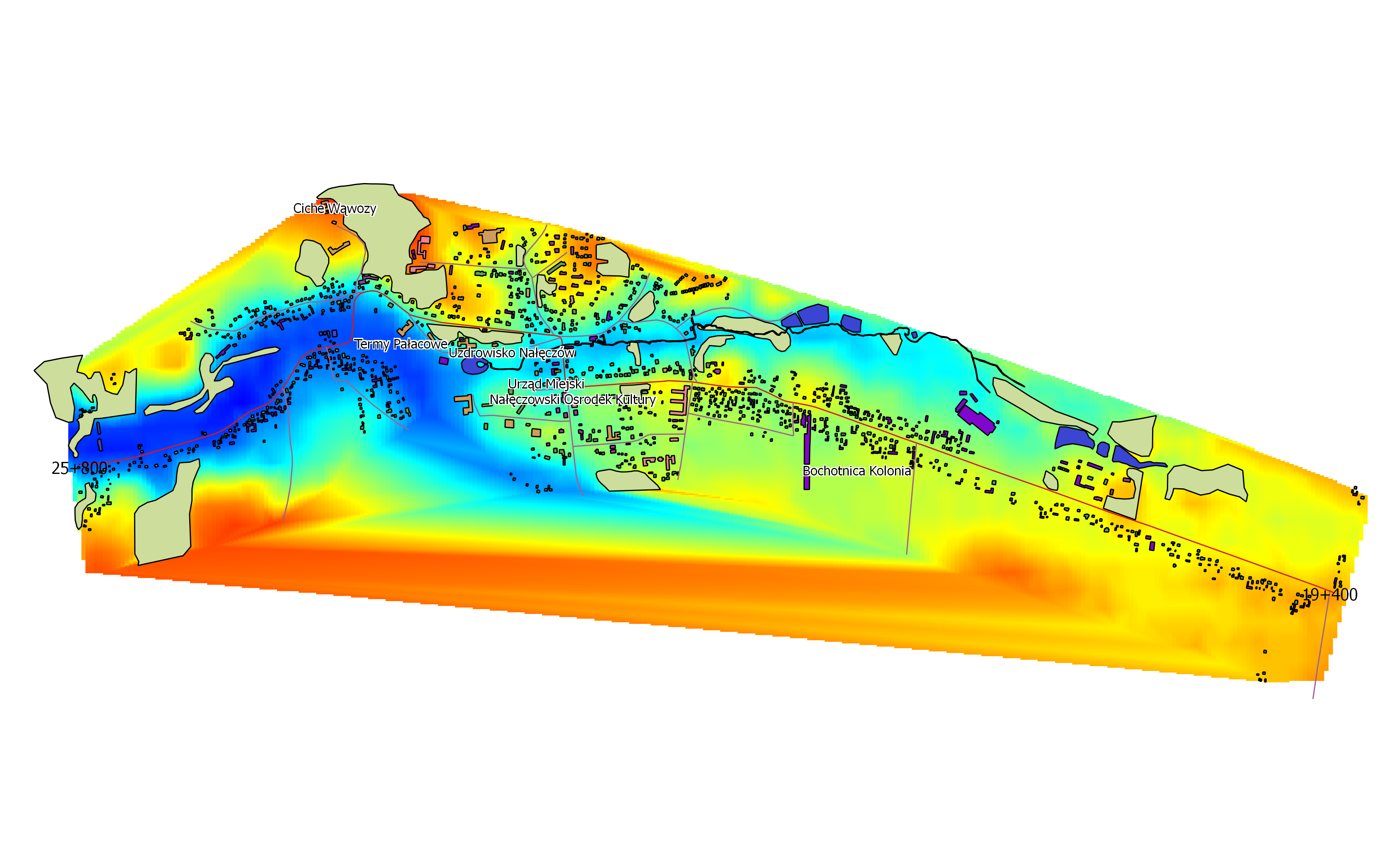
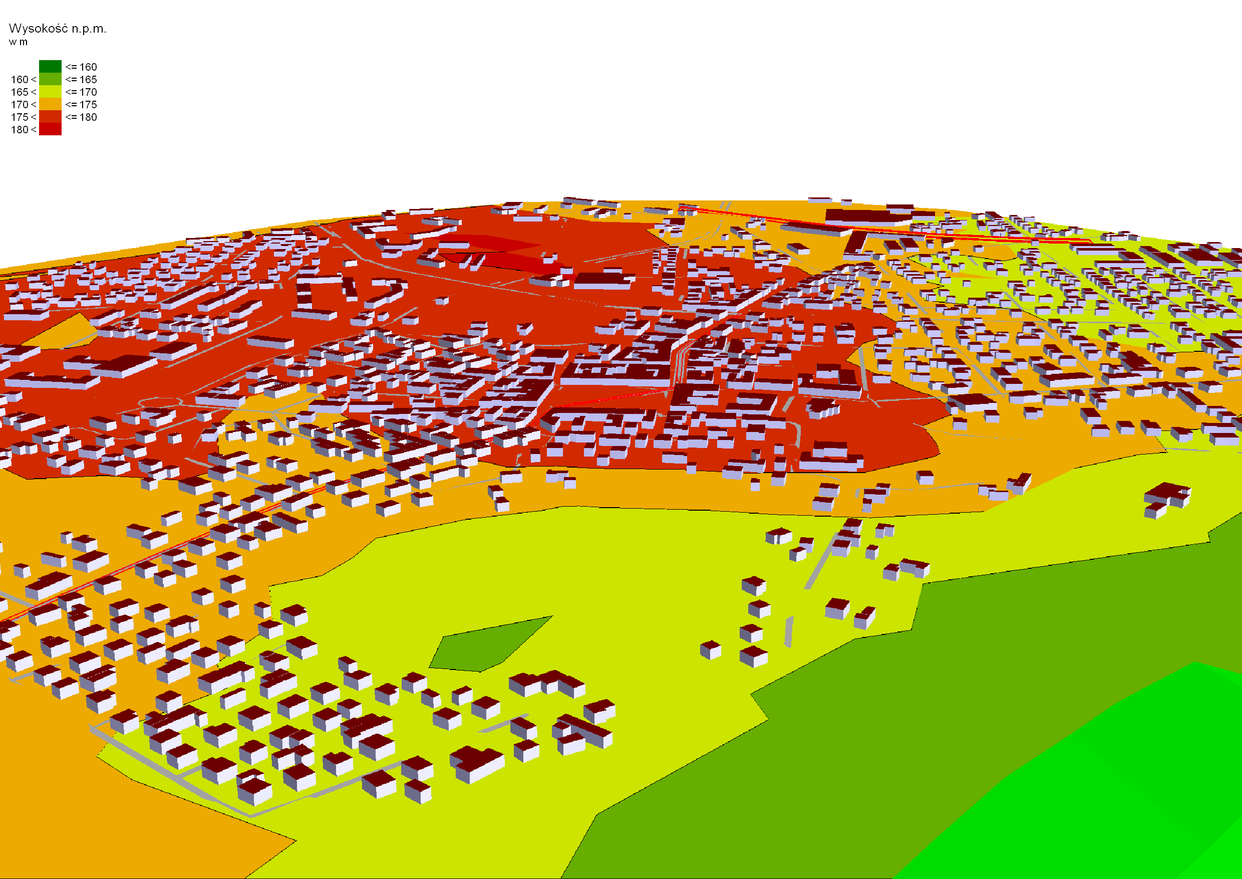
NMT wykonany z użyciem programu QuantumGIS
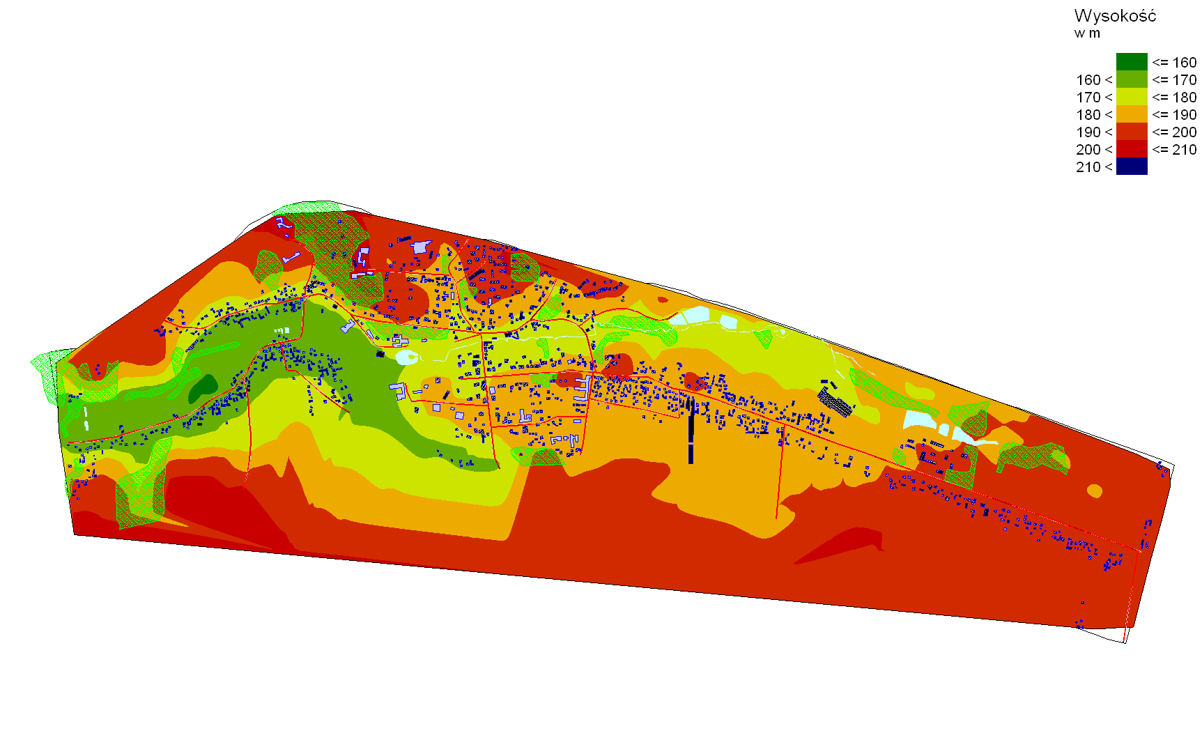
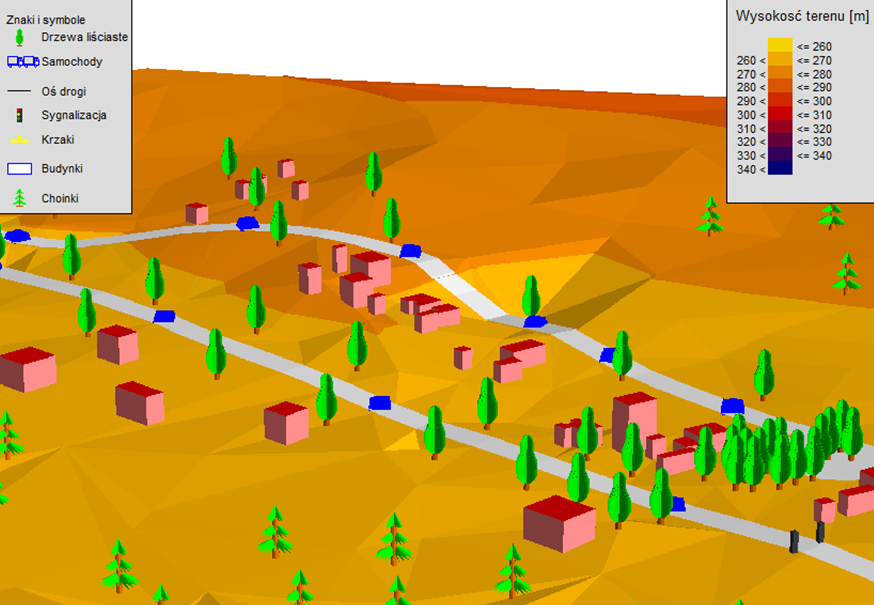
NMT wykonany z użyciem programu SoundPLAN

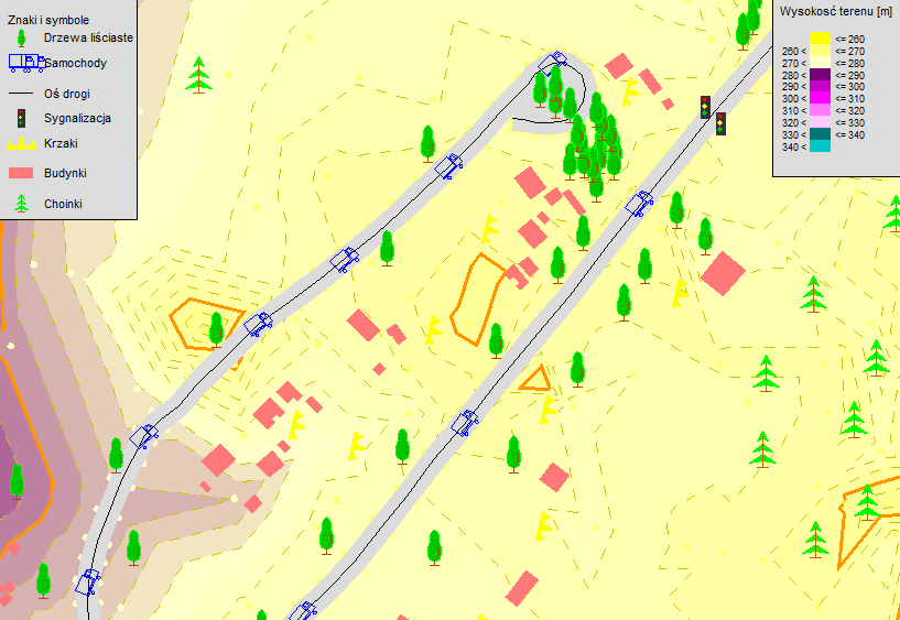
Numeryczny model rzeźby terenu
 Klaster Maszyn Górniczych